
Business Details
14 Years
experience
Your Trusted Partner for Surveying Solutions
Established in 2012, Tribrach has built a reputation for delivering precise surveying and setting-out services across the UK construction industry. Our team combines over 20 years of sector-specific expertise with cutting-edge technology, including Topcon robotic total stations and RTK GPS equipment, to ensure millimetre-perfect accuracy. We collaborate proactively with architects, engineers, and site managers to provide cost-effective solutions tailored to both large-scale and small projects.Our commitment to using the latest survey-grade tools and methodologies ensures clients receive reliable results within agreed timelines and budgets. All engineers hold relevant qualifications and certifications, including CSCS cards and public liability insurance, reinforcing our dedication to professionalism and safety.

Services
Setting Out
Surveying
Aerial Drone Mapping
Topographical Surveys
GPS Station Control
Stock Pile Volumes
Cut & Fill Surveys
As-Built Surveys
AutoCAD Drawings
Floor Level Surveys
Details
- Year established: 2012
Highlights and features
- We utilise Topcon robotic total stations and RTK GPS for survey-grade accuracy.
- Our engineers hold CSCS cards and public liability insurance.
- Proactive collaboration with architects and engineers ensures client peace of mind.
- Competitive quotes tailored to hourly, daily, or full-time project needs.
- Over 20 years of experience in construction and groundworks sector.
Associations and certifications
- CAA Certified
Services
Setting Out
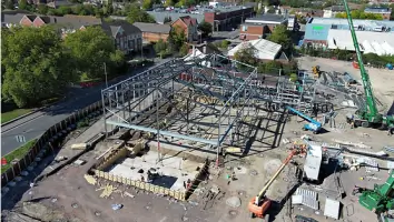
We provide precise on-site marking of buildings and structures using robotic total stations and GPS. Our engineers ensure accurate placement of foundations, steel columns, and drainage systems. This service guarantees millimetre-perfect alignment for residential and commercial projects.
Aerial Drone Mapping
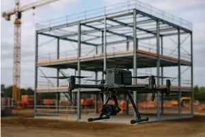
Our drone mapping service captures high-resolution orthomosaic imagery and 3D models for land surveying. Using RTK GPS integration, we deliver survey-grade data for construction monitoring, farm mapping, and planning applications. This technology ensures rapid, cost-effective results with millimetre accuracy.
Topographical Surveys
We conduct detailed topographical surveys to map terrain features and elevations. Our services support architectural design, flood risk assessments, and site development plans. Advanced GPS and drone technology ensure precise, CAD-ready contour maps for engineering projects.
As-Built Surveys
Our as-built surveys verify completed structures against original designs using laser scanning and GPS. This service ensures compliance with planning permissions and identifies deviations. Clients receive accurate AutoCAD drawings for documentation and future modifications.
GPS Station Control
We establish GPS station control networks for large-scale projects using advanced GNSS technology. This service provides a reliable reference framework for construction and land development. Continuous satellite tracking ensures long-term accuracy for infrastructure projects.
Questions
What areas do you cover for surveying services?
We operate nationwide across the UK, with a focus on Wiltshire, Bristol, and surrounding regions for construction and land development projects.
Do you offer drone surveying for agricultural land?
Yes, our drone mapping services include farm field analysis, drainage assessments, and estate boundary mapping using RTK GPS precision.
What qualifications do your engineers hold?
Our team holds Civil Engineering ONC/HNC qualifications, CSCS cards, and SMSTS certifications, ensuring compliance with industry safety and technical standards.
Can you handle both small and large projects?
We provide flexible services for projects of all scales, from single residential properties to large commercial developments and infrastructure works.
How quickly can you deliver survey data?
Using advanced technology, we typically provide processed data within 24-48 hours of on-site work completion, depending on project complexity.
Are you insured for surveying operations?
All engineers have public liability and indemnity insurance, with CAA certification for commercial drone operations across the UK.